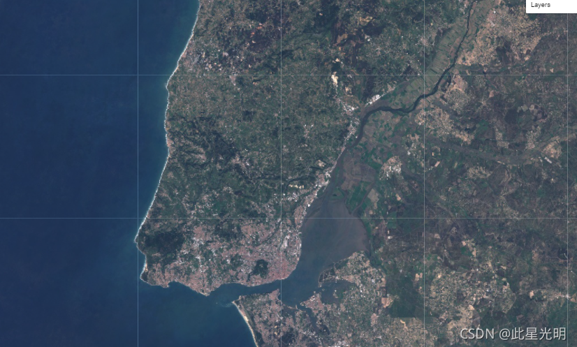
之前有粉丝在公众号问我,对于sentinel2是否需要进行去云的问题,这里就简单写一下关于这个数据的问题:
现在回答是因为所有光学影像都是需要去云的,因为遇到没有云的影像概率太小了,况且数据预处理阶段的去云是必不可少的一个关键环节,一般在GEE平台需要的处理就是去云处理,而很多modis数据和Landsat8数据,以及sentinel数据都是通过QA波段的位掩技术实现的。所以一般无论做反演还是监测都需要进行这一步修正。
现在先给大家推荐一个官方的文档介绍的链接:
Sentinel-2 User Handbook https://sentinel.esa.int/documents/247904/685211/Sentinel-2_User_Handbook
哨兵-2是一项宽幅、高分辨率、多光谱成像任务,支持哥白尼土地监测研究,包括监测植被、土壤和水覆盖,以及观测内陆水道和沿海地区。
哨兵-2的数据包含13个UINT16光谱带,代表TOA反射率,以10000米为尺度。详见Sentinel-2用户手册。此外,还有三个QA波段,其中一个(QA60)是一个带有云层遮蔽信息的比特掩码波段。
每个Sentinel-2产品(压缩档案)可能包含多个产品。每个产品成为一个单独的地球引擎资产。Sentinel-2资产的EE资产ID有以下格式。COPERNICUS/S2/20151128T002653_20151128T102149_T56MNN. 这里第一个数字部分代表传感日期和时间,第二个数字部分代表产品生成日期和时间,最后一个6个字符的字符串是唯一的颗粒标识符,表示其UTM网格参考(见MGRS)。
GEE上的波段介绍:
Dataset Availability
2015-06-23T00:00:00 - 2021-11-23T00:00:00
Dataset Provider
European Union/ESA/Copernicus
Collection Snippet
ee.ImageCollection("COPERNICUS/S2")
Bands Table
Name | Description | Resolution | Wavelength | Scale |
B1 | Aerosols | 60 meters | 443.9nm (S2A) / 442.3nm (S2B) | 0.0001 |
B2 | Blue | 10 meters | 496.6nm (S2A) / 492.1nm (S2B) | 0.0001 |
B3 | Green | 10 meters | 560nm (S2A) / 559nm (S2B) | 0.0001 |
B4 | Red | 10 meters | 664.5nm (S2A) / 665nm (S2B) | 0.0001 |
B5 | Red Edge 1 | 20 meters | 703.9nm (S2A) / 703.8nm (S2B) | 0.0001 |
B6 | Red Edge 2 | 20 meters | 740.2nm (S2A) / 739.1nm (S2B) | 0.0001 |
B7 | Red Edge 3 | 20 meters | 782.5nm (S2A) / 779.7nm (S2B) | 0.0001 |
B8 | NIR | 10 meters | 835.1nm (S2A) / 833nm (S2B) | 0.0001 |
B8A | Red Edge 4 | 20 meters | 864.8nm (S2A) / 864nm (S2B) | 0.0001 |
B9 | Water vapor | 60 meters | 945nm (S2A) / 943.2nm (S2B) | 0.0001 |
B10 | Cirrus | 60 meters | 1373.5nm (S2A) / 1376.9nm (S2B) | 0.0001 |
B11 | SWIR 1 | 20 meters | 1613.7nm (S2A) / 1610.4nm (S2B) | 0.0001 |
B12 | SWIR 2 | 20 meters | 2202.4nm (S2A) / 2185.7nm (S2B) | 0.0001 |
QA10 | Always empty | 10 meters | 0 | |
QA20 | Always empty | 20 meters | 0 | |
QA60 | Cloud mask | 60 meters | 0 | |
QA60 Bitmask |
| |||
以下是官网给出的去云的内容介绍:
Cloud Masks
The Level-1C products embed:
- Vector mask (GML format)
- cloud mask including an indicator specifying cloud type:
- dense cloud
- cirrus cloud
- statistical information: percentage of cloudy pixels and of cirrus pixels in the cloud mask.
Cloud Mask (Dense/Cirrus)
The cloud mask enables cloudy and cloud-free pixels to be identified. The mask includes both dense clouds and cirrus clouds with an indicator specifying the cloud type.
Processing is performed with data sampled at 60 m spatial resolution for all spectral bands.
Identification of Dense Clouds
The dense clouds, also called opaque clouds, are characterised by a high reflectance in the blue spectral region (B2).
The method used to identify dense cloud pixels is based on B2 reflectance threshold. To avoid false detection, mainly due to snow/cloud confusion, SWIR reflectance in B11 and B12 are also used. Snow and clouds both have a high reflectance in the blue. Cloud reflectance is high in the SWIR, whereas snow presents a low reflectance.
Additional criteria based on B10 reflectance are added to avoid high altitude ice cloud and snow confusion (both having a low reflectance in the SWIR bands B11 and B12). At B10, there is a high atmospheric absorption band and only high altitude clouds are detected. However, this last criterion is only applied after a first detection of cloud pixel in the blue band where cirrus is transparent.
Cirrus Cloud
Cirrus clouds are thin, transparent or semi-transparent clouds, forming at high altitudes, approximately 6-7 km above the Earth's surface.
The method of identifying cirrus cloud pixels from dense cloud pixel is based on two spectral criteria:
- B10 corresponds to a high atmospheric absorption band: only high altitude clouds can be detected
- cirrus cloud, being semi-transparent, cannot be detected in the B2 blue band.
A pixel with low reflectance in the B2 band and high reflectance in the B10 band has a good probability of being cirrus cloud but this is not a certainty. Some opaque clouds have a low reflectance in the blue and can be identified as cirrus cloud.
To limit false detections (due to high reflectance in the blue or due to the fact that clouds are not spectrally registered), a filter using morphology-based operations is applied on both dense and cirrus masks performing:
- erosion, to remove isolated pixels
- dilatation, to fill the gap and extend clouds.
If after morphology operations, a pixel is both dense and cirrus, the dense cloud mask prevails.
The cloud mask can be set to three values:
- 0 is a cloud-free pixel
- 1 is a dense cloud pixel
- 2 is a cirrus cloud pixel.
If measurements are not available in one or several bands needed to calculate the cloud mask, the mask value is set to NODATA.
After all filtering steps, the cloud mask is available at a spatial resolution of 60 m. It is then re-sampled at spatial resolutions of 10 m and 20 m for each corresponding spectral band. The re-sampling is not a geometric transformation but a radiometric interpolation.
All these processing steps ensure that a pixel identified as cloud-free is actually cloud-free.


