一、
描述:
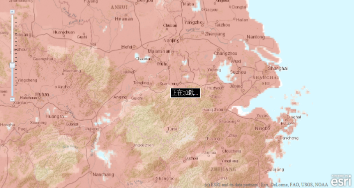
此示例演示了如何使用动画图像显示的地图正在加载。图像是一个小的GIF动画。图像出现在地图第一次加载和用户缩放或平移时已加载,所有图层加载完毕的图像消失。
在线演示:http://help.arcgis.com/en/webapi/javascript/arcgis/samples/map_showloading/index.html
引用联接:http://help.arcgis.com/en/webapi/javascript/arcgis/help/jssamples_start.htm
例子中使用事件驱动方式。onUpdateStart函数是在更新地图内容时显示图片。onUpdateEnd函数是在更新加载完毕后将图片消失。
图片路径被引用在HTML的身体。您可以使用命名空间的方法esri.show 和 esri.hide切换图像显示。
代码如下:
<!DOCTYPE html PUBLIC "-//W3C//DTD HTML 4.01//EN" "http://www.w3.org/TR/html4/strict.dtd">
<html lang="en">
    <head>
    <meta http-equiv="Content-Type" content="text/html; charset=utf-8">
    <meta http-equiv="X-UA-Compatible" content="IE=7,IE=9" />
    <!--The viewport meta tag is used to improve the presentation and behavior of the samples on iOS devices-->
    <meta name="viewport" content="initial-scale=1, maximum-scale=1,user-scalable=no"/>
    <title>地图加载图像</title>
    <link rel="stylesheet" type="text/css" href="http://serverapi.arcgisonline.com/jsapi/arcgis/3.2/js/dojo/dijit/themes/claro/claro.css">
    <link rel="stylesheet" type="text/css" href="http://serverapi.arcgisonline.com/jsapi/arcgis/3.2/js/esri/css/esri.css" />
    <script type="text/javascript" src="http://serverapi.arcgisonline.com/jsapi/arcgis/?v=3.2"></script>
    <script type="text/javascript">
      dojo.require("esri.map");

      var map;
      var loading;

      /**
       * 初始化函数
       */
      function init() {
        loading = dojo.byId("loadingImg");  // 加载图像. DomID
        var initialExtent = new esri.geometry.Extent(   // 地图范围
            11858134,   // 右上角X坐标
            2685691,    // 左下角X坐标
            14362823,   // 右上角Y坐标
            3938035,    // 左下角Y坐标
            new esri.SpatialReference({ // 空间参考
                wkid:102100
            })
        );
        map = new esri.Map("map",{
            extent:initialExtent    // 范围
            }
        );
        dojo.connect(map,"onUpdateStart",showLoading);  // 绑定函数
        dojo.connect(map,"onUpdateEnd",hideLoading);


        // 一个URL到地图中的地图服务。
        var tiledMapServiceLayer = new esri.layers.ArcGISTiledMapServiceLayer("http://server.arcgisonline.com/ArcGIS/rest/services/World_Topo_Map/MapServer");
        map.addLayer(tiledMapServiceLayer);     // 添加到地图中

        // 非缓存的地图服务的URL。
        var dynamicMapServiceLayer = new esri.layers.ArcGISDynamicMapServiceLayer("http://sampleserver1.arcgisonline.com/ArcGIS/rest/services/Demographics/ESRI_Population_World/MapServer");
        dynamicMapServiceLayer.setOpacity(0.4);     // 设置透明度
        map.addLayer(dynamicMapServiceLayer);

      }
        function showLoading() {
          esri.show(loading);   // 显示图片
          map.disableMapNavigation();   // 禁止所有的地图导航,除了滑块和平移箭头。
          map.hideZoomSlider();  // 隐藏地图的缩放滑块。
        }

        function hideLoading(error) {
          esri.hide(loading);
          map.enableMapNavigation();
          map.showZoomSlider();
        }
      dojo.addOnLoad(init);     // 初始化加载
    </script>
    </head>
    <body class="claro">
    <div id="map" style="position:relative; width:1024px; height:512px; border:1px solid #000;">
        <img id="loadingImg" src="images/loading.gif" style="position:absolute; right:512px; top:256px; z-index:100;" />
    </div>
</body>
</html>
显示效果如下:
二、
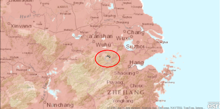
描述方式同上,这个加载文字效果。与图片相比,少了些步骤而已,其实也挺简单的
在线演示:http://help.arcgis.com/en/webapi/javascript/arcgis/samples/map_showloadingtext/index.html
引用联接:http://help.arcgis.com/en/webapi/javascript/arcgis/help/jssamples_start.htm
代码如下:
<!DOCTYPE html PUBLIC "-//W3C//DTD HTML 4.01//EN"
   "http://www.w3.org/TR/html4/strict.dtd">
<html lang="en">
<head>
    <meta http-equiv="Content-Type" content="text/html; charset=utf-8">
    <meta http-equiv="X-UA-Compatible" content="IE=7,IE=9" />
    <!--The viewport meta tag is used to improve the presentation and behavior of the samples  on iOS devices-->
    <meta name="viewport" content="initial-scale=1, maximum-scale=1,user-scalable=no"/>
    <title>地图加载文字</title>

    <link rel="stylesheet" type="text/css" href="http://serverapi.arcgisonline.com/jsapi/arcgis/3.2/js/dojo/dijit/themes/claro/claro.css">
    <link rel="stylesheet" type="text/css" href="http://serverapi.arcgisonline.com/jsapi/arcgis/3.2/js/esri/css/esri.css" />
  <!-- css to style the loading text-->
  <style>
      #mapDiv {
        border: 1px solid #666;
      }

      #status {
  background-color: black;
  color: white;
  padding: 3px;
  border: solid 1px white;
  -moz-border-radius: 5px;
  -webkit-border-radius: 5px;
  width: 79px;
      }

    </style>
<script type="text/javascript" src="http://serverapi.arcgisonline.com/jsapi/arcgis/?v=3.2"></script>
    <script type="text/javascript">
      dojo.require("esri.map");   // 导入包

      var map;

      function init() {
        var initialExtent = new esri.geometry.Extent( // 范围
      11858134,
      2685691,
      14362823,
      3938035,
      new esri.SpatialReference({   // 空间参考
        wkid:102100
      })
    );
        map = new esri.Map("map",{extent:initialExtent});

        dojo.connect(map,"onUpdateStart",function(){
          esri.show(dojo.byId("status"));
        });
        dojo.connect(map,"onUpdateEnd",function(){
          esri.hide(dojo.byId("status"));
        });


        // 一个URL到地图中的地图服务
        var tiledMapServiceLayer = new esri.layers.ArcGISTiledMapServiceLayer("http://server.arcgisonline.com/ArcGIS/rest/services/World_Topo_Map/MapServer");
        map.addLayer(tiledMapServiceLayer);


         // 非缓存的地图服务的URL
        var dynamicMapServiceLayer = new esri.layers.ArcGISDynamicMapServiceLayer("http://sampleserver1.arcgisonline.com/ArcGIS/rest/services/Demographics/ESRI_Population_World/MapServer");
        dynamicMapServiceLayer.setOpacity(0.4);
        map.addLayer(dynamicMapServiceLayer);

      }

      dojo.addOnLoad(init);  // 初始化加载
    </script>
  </head>
<body class="claro">
    <div id="map" style="position:relative; width:1024px; height:512px; border:1px solid #000;">
      <span id="status" style="position: absolute; z-index: 100; right: 443px; top: 242px;">
      正在加载...
      </span>
  </div>
</body>
</html>
效果如下图: